Atlas
A spatial workspace for analysts and developers. Search any parcel in Germany. Read its full regulatory and zoning history. Assemble investment-ready evidence - source-attached - in one screen.
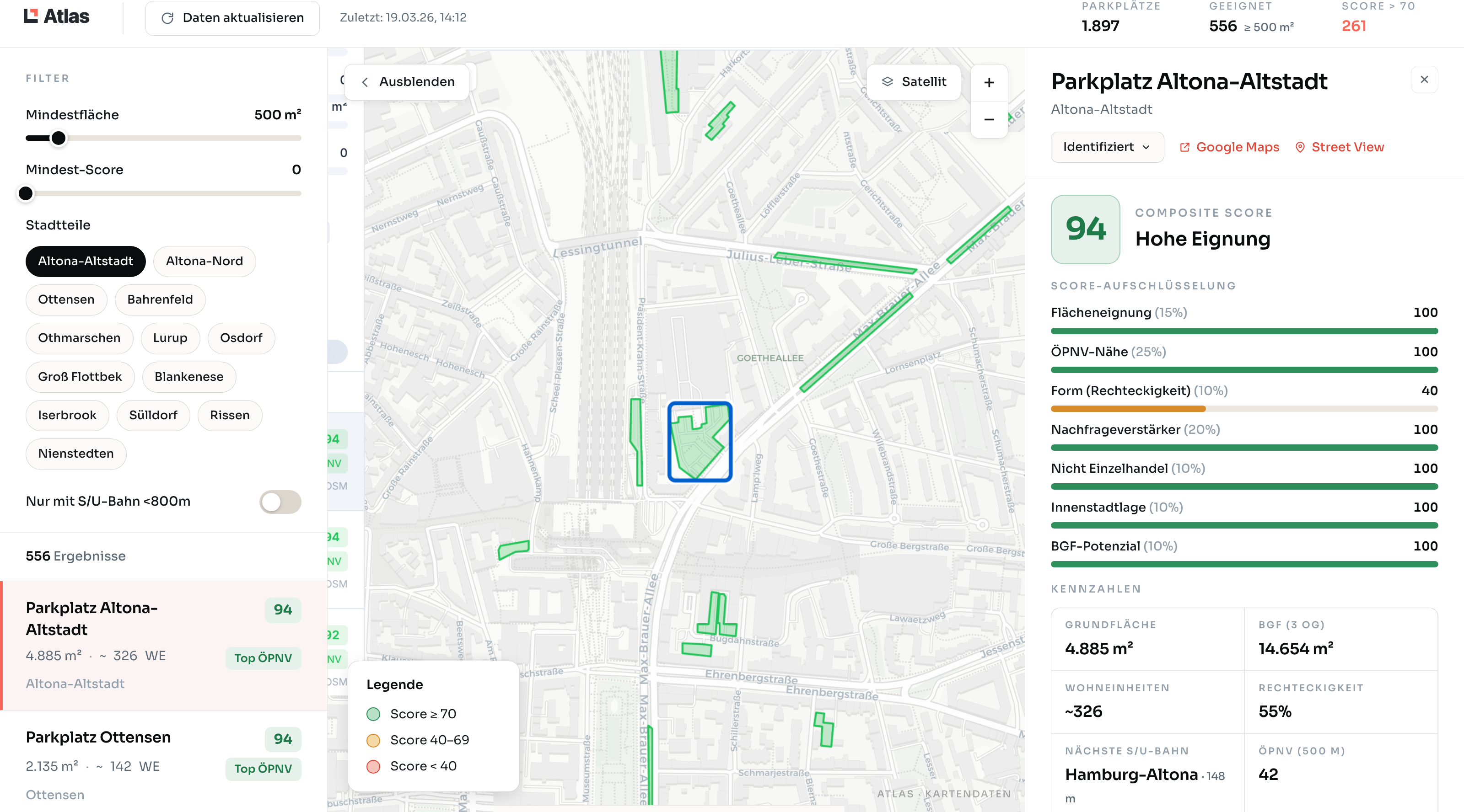
Atlas - candidate screening with composite score, component breakdown, and Kennzahlen for the selected parcel.
Scope & coverage
11,054
Municipalities in scope
Phased rollout · 16 Bundesländer
60M
Parcels in scope
ALKIS-anchored
10y
Regulatory history target
Backfill in progress
Same-day
Publish-to-index
Sub-hour in pipeline
What Atlas does
Built for the analyst's actual day.
Parcel search
By Flurstück, address, or coordinate.
Type any German parcel ID, postcode + Strasse, or lat/lon. We resolve it across the municipalities we've indexed - phased rollout to all 11,054 in 2026, no atlas-shopping.
Regulatory timeline
Every signal, on a single ribbon.
B-Plans, Satzungen, Bauanträge, Anhörungen - all bound to the parcel, all source-attached, going back the full coverage window.
Evidence packs
Export a board-ready bundle.
One click to assemble a parcel's full file - map, regulatory history, source PDFs, ownership trace - as a citable PDF.
Cross-parcel comparison
Stack two assets side by side.
Diligencing the alternative? Open both parcels in split view and compare regulatory exposure, signal velocity, and adjacent risk.
“Every parcel's regulatory history in one screen - source-attached, citable, exportable. If we say it, we can prove it.”Atlas · Product principle
Bring us a parcel. We'll show you everything.
Send a Flurstücknummer. We'll open Atlas on the screen and walk you through every signal that touched it - and the original PDFs underneath.
Per-seat licence · DE/EN · NDA on request